The rock under your property influences soil fertility, slope stability, water availability, and even which native plants grow there.
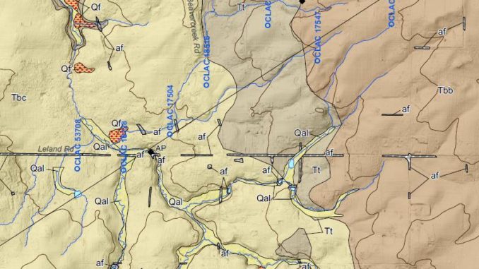
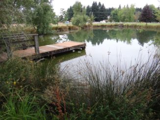
Our Beavercreek farm can be seen on the Geologic Map of the Oregon City 7.5′ Quadrangle, Clackamas County, Oregon (a higher resolution map is available here), at the intersection of South Beavercreek Road and Ferguson Road. (The two ponds on the farm appear on the map near the artificial fill under Beavercreek Road and Ferguson Road.)
The farm is located on the edge of a plateau, at the contact between Canemah Basalt (shown as Tbc on the geologic map) and Troutdale Formation sedimentary rocks (shown as Tt on the map). The higher hills near the farm are composed of Beaver Creek Basaltic Andesite (Tbb on the map).
The local geology is like an ice cream sandwich, with volcanic layers as the cake surrounding the sedimentary rock filling. As you drive eastward from the Beavercreek General Store toward the farm, you are driving on top of Canemah Basalt. Just about the time you reach the farm, you are on Troutdale Formation. About a quarter mile up the road from the farm, you are on Beaver Creek Basaltic Andesite.
The volcanic rocks above and below the Troutdale Formation are described as “diktytaxitic” which means the rock has an open texture with small openings. These pore spaces (called “vesicles” by geologists) can hold significant amounts of groundwater. However, if the pores aren’t connected, the rock is not permeable and water can’t flow through it.
Sandstone, siltstone, and mudstone make up the Troutdale Formation. These sedimentary rocks are often more permeable than volcanic rocks, acting rather like a wet sponge sitting on top of a sealed surface.
Narrative history from the previous owner lends support to this idea of a sponge on a sealed surface. During excavation of the large pond, he noted a layer where water poured into the excavation like water flowing from a pipe. That is how water flowing along the contact between sedimentary and volcanic layers might be described.
These rocks formed during the Pliocene age between 5.332 million to 2.588 million years ago. Geologically, these are quite young rock formations.
Also, I note that Missoula flood deposits do not occur at the elevation of the farm. The Beavercreek farm was just a little too high in elevation to be covered by sediment-carrying floodwater.
Disclaimer: While I used to be a licensed professional geologist (Wyoming), I am no longer registered as a geologist.


